


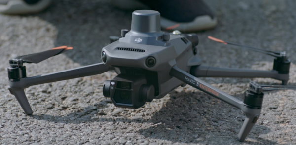
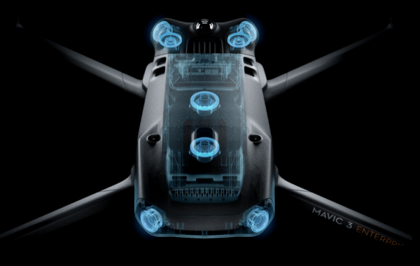


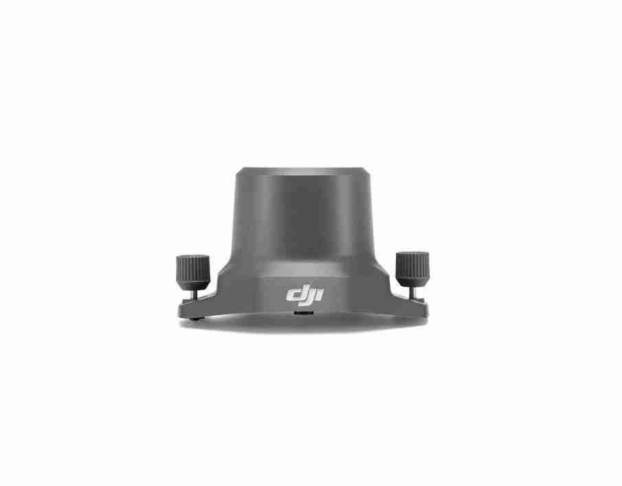
DJI Mavic 3 Enterprise Drone w/Enterprise Care Basic 1 Year Warranty Included The Mavic 3 Enterprise Series redefines industry standards for small commercial drones. With a mechanical shutter, a 56× zoom camera, and an RTK module for centimeter-level precision, the Mavic 3E brings mapping and mission efficiency to new heights. A thermal version is available for firefighting, search and rescue, inspection, and night operations. Compact and Portable Streamlined and compact, Mavic 3 Enterprise Series can be carried in one hand and deployed at a moment’s notice. Perfect for beginner and veteran pilots alike, it’s built to perform on lengthy missions. Two Models, Countless Applications Wide Camera 4/3 CMOS, 20MP, Mechanical Shutter Equivalent Focal Length: 24mm, 48MP Telephoto Camera Equivalent Focal Length: 162mm, 12MP, 56× Hybrid Zoom Premium Camera Performance Survey with Speed Mavic 3E’s wide-angle 4/3 CMOS, 20MP sensor has a mechanical shutter to prevent motion blur and supports rapid 0.7-second interval shooting. Complete mapping missions with extraordinary efficiency without the need for Ground Control Points. Improved Low-Light Performance Mavic 3E’s Wide camera has large 3.3μm pixels that, together with intelligent low-light mode, offer significantly improved performance in dim conditions. Focus and Find Both Mavic 3E and Mavic 3T are equipped with a 12MP Zoom Camera, supporting up to 56× Max Hybrid Zoom to see essential details from afar. Exceptional Operational Efficiency Batteries Optimized For Endurance 45-min flight durations let you cover more ground each mission, for surveying of up to 2 square kilometers in a single flight. [3][5] Max Flight Time 45 Minutes [3] Surveying Area in a Single Flight 2 Square Kilometers[5] Fast charge batteries with 100W charging hub, or directly charge the drone with 88W fast charging. Charging Hub 100W Aircraft 88W Next-Generation Image Transmission Four built-in antennas support O3 Enterprise Transmission, with two antennas to transmit signals and four antennas to receive signals. The aircraft and remote controller both support the DJI Cellular Dongle.* This enables 4G Enhanced Transmission to work with O3 Enterprise Transmission for seamless operation in complex environments, helping to ensure safer flights. Omnidirectional Sensing for Safe Flying Equipped with wide-angle lenses on all sides for omnidirectional obstacle avoidance with zero blind spots. Adjust proximity alarms and braking distance depending on mission requirements. [6] Advanced RTH automatically plans the optimal route home, saving power, time, and hassle. APAS 5.0 enables automatic rerouting around obstacles, so you can fly with peace of mind. [7] Real-Time Terrain Follow Automatically adjust altitude when mapping areas with variations in elevation, all without needing to import external elevation data thanks to Mavic 3E’s omnidirectional sensing. [8] Automatically adjust altitude when mapping areas with variations in elevation, all without needing to import external elevation data thanks to Mavic 3E’s omnidirectional sensing. [8] Smart Oblique Capture Elevate the efficiency of your oblique photography mission with Smart Oblique Capture. During flight, the gimbal automatically rotates in three directions: front, middle, and back. Two routes can collect all photos at the angles needed for high-precision 3D modeling. Elevate the efficiency of your oblique photography mission with Smart Oblique Capture. During flight, the gimbal automatically rotates in three directions: front, middle, and back. Two routes can collect all photos at the angles needed for high-precision 3D modeling. Live Mission Recording Record mission actions such as aircraft movement, gimbal orientation, photo shooting, and zoom level to create sample mission files for future automated flights. Record mission actions such as aircraft movement, gimbal orientation, photo shooting, and zoom level to create sample mission files for future automated flights. Corridor Mission Planning Create automated flight missions of highways, rivers, oil pipelines, and more with Corridor Mission Planning. Simply draw a line on the map and it divides the area into mappable segments for straightforward surveying. Create automated flight missions of highways, rivers, oil pipelines, and more with Corridor Mission Planning. Simply draw a line on the map and it divides the area into mappable segments for straightforward surveying. Abundant Accessories DJI RC Pro Enterprise [8] A portable remote controller with a 1,000-nit high-brightness screen for clear visibility in direct sunlight, a built-in microphone for clear communication, and 1.5-hour 65W fast charging. RTK Module [4] Achieve centimeter-level accuracy with RTK and support for network RTK, custom network RTK services, and D-RTK 2 Mobile Station. Loudspeaker [4] Broadcast your message from above, with support for text-to-speech, audio storage, and looping, to improve search and rescue efficiency. DJI Cellular Dongle* It provides 4G Enhanced Transmission between the drone and the remote controller, and also facilitates mobile network access for the remote controller. D-RTK 2 Mobile Station [4] D-RTK 2 Mobile Station is DJI’s upgraded high-precision GNSS receiver that supports all major global satellite navigation systems, providing real-time differential corrections that generate centimeter-level positioning data for improved relative accuracy. DJI RC Pro Enterprise [8] RTK Module [4] Loudspeaker [4] DJI Cellular Dongle* D-RTK 2 Mobile Station [4] Full Software Suite DJI Pilot 2 DJI FlightHub 2 DJI Terra DJI Thermal Analysis Tool 3.0 A revamped Enterprise flight interface designed to improve piloting efficiency and flight safety. Drone and payload controls can be easily accessed with one tap. Clear presentation of flight details and navigational information improves user experience together with support for various route types. User Data Security Local Data Mode One-Tap Clear All Device Data AES-256 Video Transmission Encryption Cloud API Open Developer Ecosystem PSDK PSDK is a unified interface that enables expansion of Mavic 3 Enterprise Series capabilities through third-party hardware. Learn More MSDK Mobile SDK 5 simplifies the development of apps to control the Mavic 3 Enterprise Series. Mobile SDK 5 is fully open source and comes with production code samples of core DJI Pilot 2 modules. Learn More Cloud API With Pilot 2’s built-in MQTT based protocols in DJI Cloud API, you can directly connect the Mavic 3 Enterprise Series to Third-Party cloud platforms without having to develop an App. Access the drone’s hardware, video live-stream, and photo data. Learn More Order Your DJI Mavic 3 Enterprise Series Today For more information about product demo or trial, leave your contact information in the form below. You can also reach out to your local dealer for more information. DJI Recommends not to fly in bad weather such as high wind (wind speeds 12m/s and above), snow, rain, lightning, fog, etc. Do not fly at altitudes above 6000 meters. Do not fly in an environment below -10° C (14° F) or above 40° C (104° F). Do not take off on moving surfaces (e.g., moving cars, boats). Do not fly in specular reflective areas such as water or snow to ensure proper operation of the visual positioning system, and fly in a well-lit environment when GNSS signals are weak. Low ambient light may cause the vision system to not work properly. Please pay attention to flight safety when flying near electromagnetic interference sources. Common sources of electromagnetic interference include high-voltage power lines, high-voltage transmission stations, radar stations, cell phone base stations, broadcast towers, Wi-Fi hotspots, routers, Bluetooth devices, etc.
Related products

Sale!
Bedsheet Set
$ 98.48
Sale!

Bedsheet Set
$ 93.52
Sale!

Bedsheet Set
$ 98.61