This interesting collage of topographic maps reflects the continent-spanning missionary efforts of the Society of Jesus (Jesuits). From Alaska to British Guiana and across remote islands in the Pacific, the Catholic order stationed dozens of priests to convert and educate the inhabitants. Seven different maps, plus a central ‘key’, reflect the geographic diversity of the historic operations and cover broad areas in Alaska, the Caribbean, Mexico, British Guiana, the Rocky Mountains, Great Lakes, Micronesia, and the Philippines. The eleven primary missions are listed in a table along the bottom of the sheet, which also outlines (in Portuguese) the Jesuits’ infrastructure and the religious practices of local populations. The missionaries (336 in total) are comprised of Americans, Spaniards, English, Canadians, and Mexicans. Published in Rome by the Secretariatus Missionum (Secretariat for Missions), the Jesuit body that oversaw global missionary activities and correspondence. The last date within the image is 1923 (the Marshall Islands), though it was likely printed a bit later.
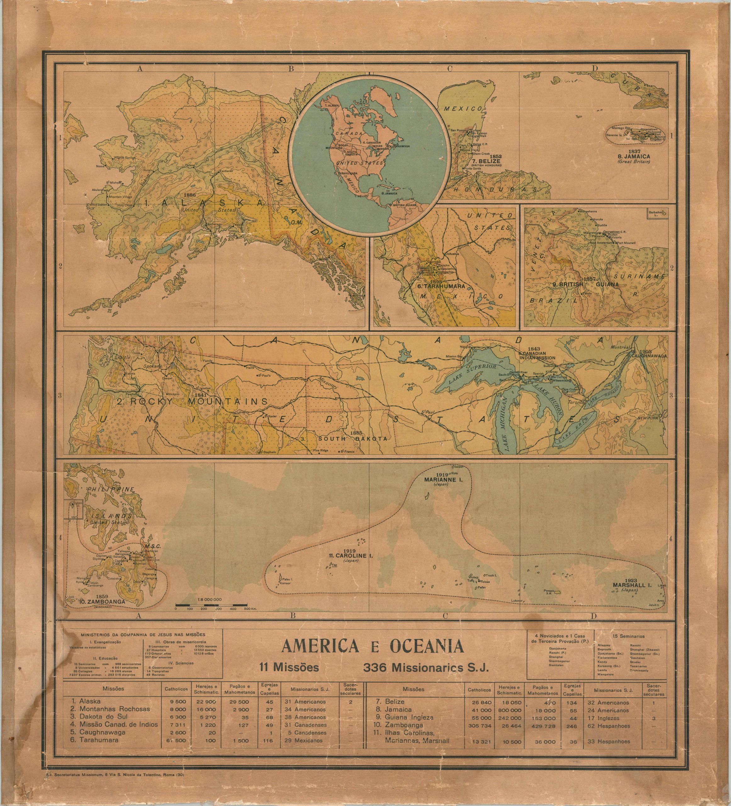
America e Oceania
$ 94.14