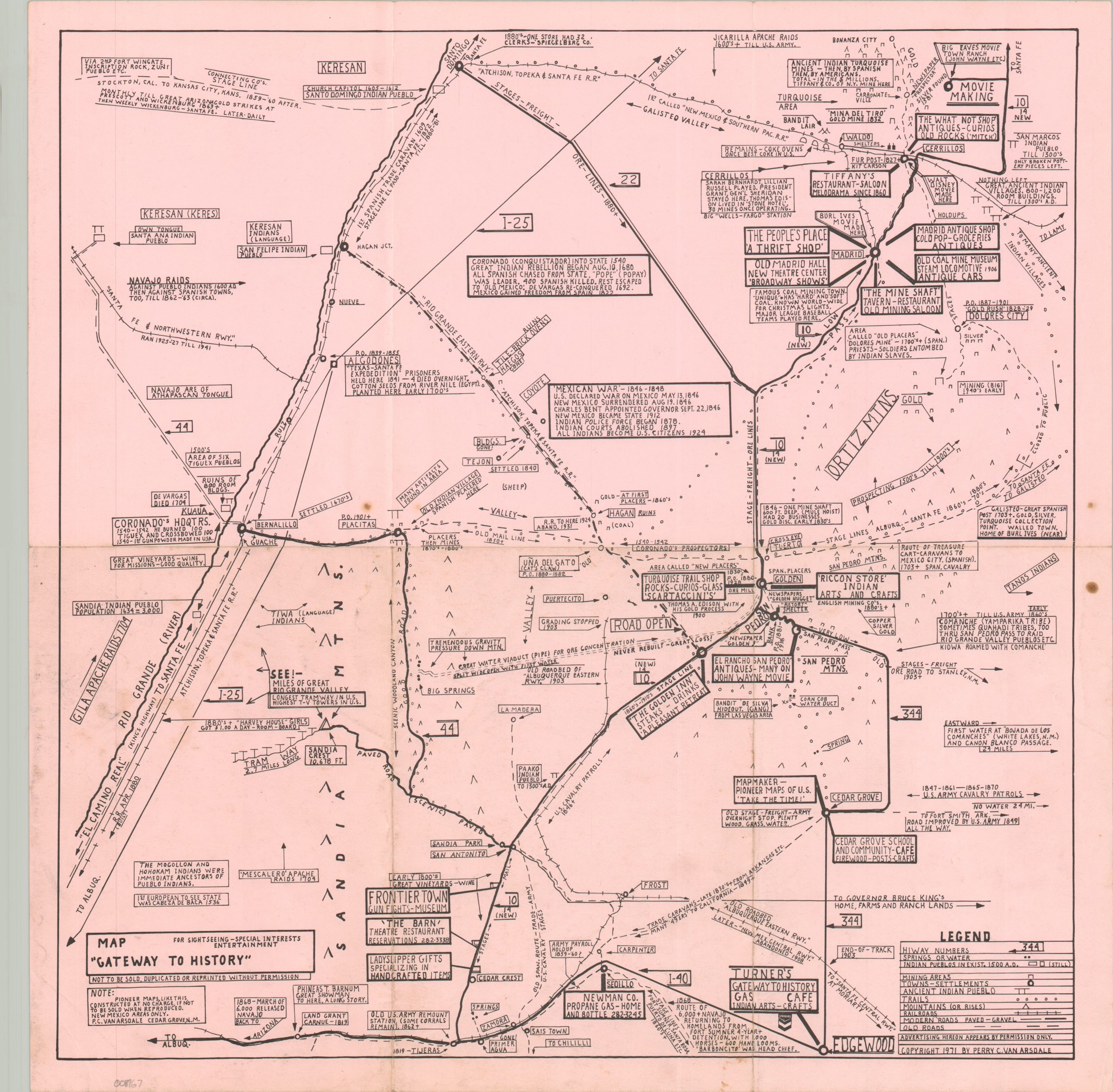
This somewhat unusual depiction of northern New Mexico’s landscape was designed ‘for sightseeing, special interests, and entertainment,” according to text in the lower left corner. The image is bordered approximately by the Rio Grande, the Atchison, Topeka & Santa Fe Railroad, the Ortiz Mountains, and Interstate 40. Scattered throughout are a myriad of symbols and lines that depict transportation routes, settlements, and geographic features from the 16th century to the present day. Scattered annotations offer even further historical details. The map was researched, drawn, copyrighted, and published in 1971 by Perry C. Van Arsdale. Van Arsdale had degrees in romance languages and mechanical engineering, both of which are reflected in the content of the image. He first created a similar publication, the Pioneer New Mexico map, after he found that those available to his seven-year-old granddaughter were insufficient. Eight more would follow, covering individual states and large regions of the United States. Van Arsdale would continue to update his maps until shortly before his passing in 1976.
Map “Gateway to History” [New Mexico]
$ 95.66