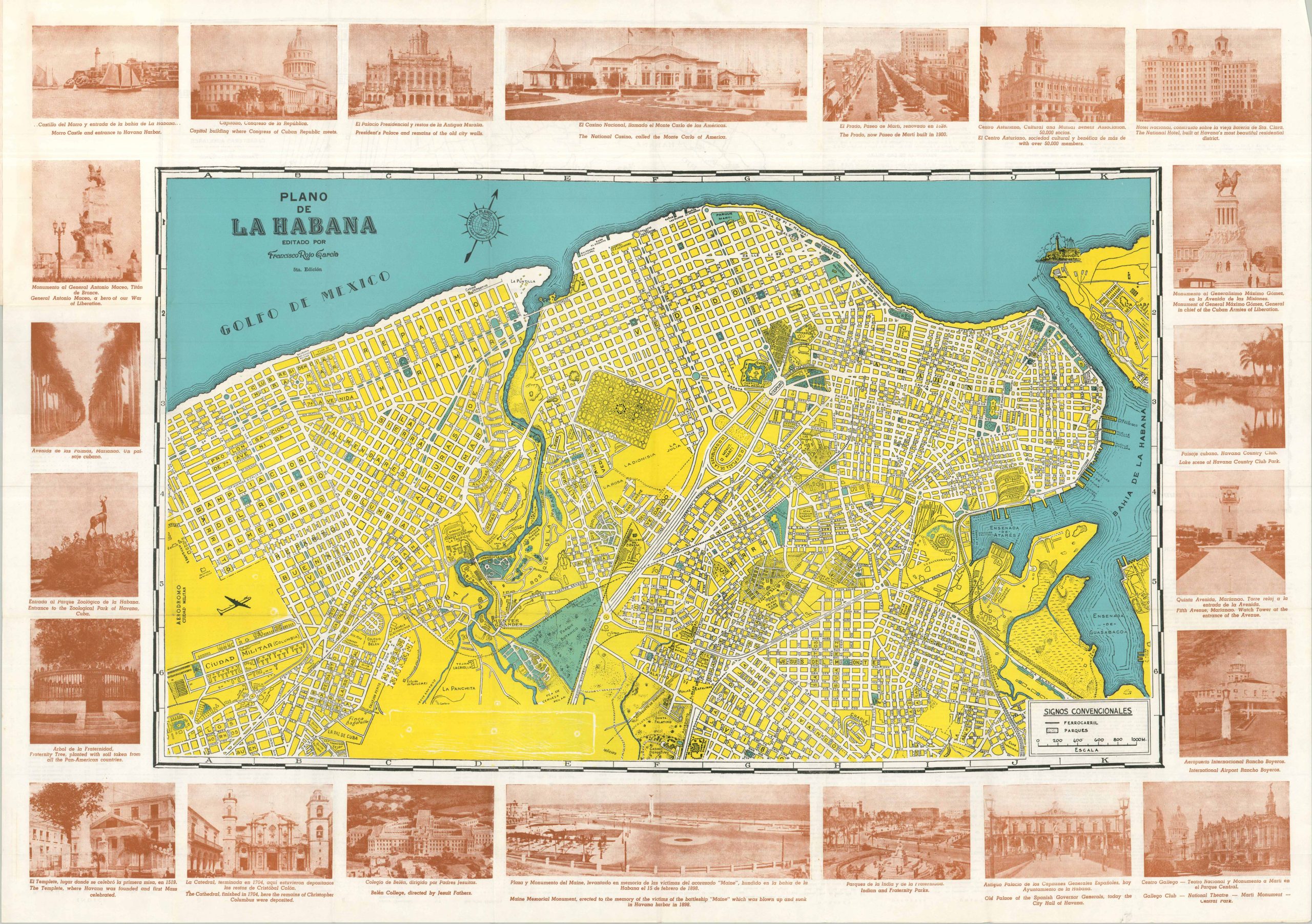
This lovely dual-language street plan of Havana presents the Cuban capital during the ‘Golden Age’ of American tourism, the period between the end of WWII and the 1959 Socialist Revolution. With commercial air travel expanding and wartime travel restrictions lifted, Havana became an easy short-haul escape for U.S. socialites looking for an exotic (yet familiar) playground. Local beaches, nightlife, gambling, favorable exchange rates, and a permissive social atmosphere all drove waves of seasonal tourism, much originating along the East Coast. These elements and more are captured within the map, published locally around 1948 by Francisco Rojo Garcia. Locations of interest, geographic features, parks, and important buildings are labeled throughout. Nearly two dozen images, somewhat shabbily captioned, around the border showcase further attractions, including the National Casino, the Monument to the Victims of the USS Maine, the Hotel Nacional, and Morro Castle. A comprehensive street index, a railroad map of Cuba, traveler information, and a map of the district of Jaimanitas can be found on the verso.
Plano de La Habana
$ 96.86